
During a typical winter, snow on the Cascade Range begins accumulating around Thanksgiving, allowing ski areas to open in late November or early December. However, the winter of 2025-2026 brought unusually warm and wet conditions that disrupted this pattern.
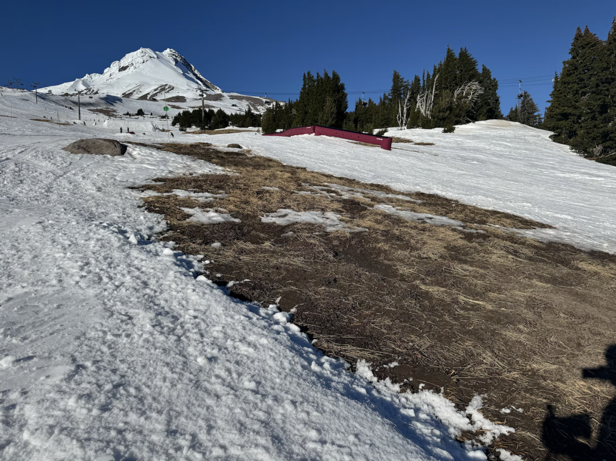
Instead of the steady snowfall, many storms arrived with higher freezing levels, causing rain to fall on the mountain rather than snow. As a result, resorts on Mt. Hood struggled to build a stable snowpack early in the season. When Mt. Hood Meadows finally opened to the public on Dec. 23, 2025, it was one of the latest season openings in more than three decades.
So why did Mt. Hood break the usual cycle this year?
The primary cause of the snow-drought was a combination of unseasonably warm temperatures and repeated rain-heavy storms. Warmer air masses pushed snow levels higher up the mountain, meaning that lower and mid-elevations received rain instead of snow, which melted any early accumulation. A critically dry January further worsened the situation, preventing the snowpack from recovering and leaving the mountain with below average snowfall totals for much of the season.
Other climate and weather experts have pointed out the type of precipitation also mattered. Federal drought noted that “more rain than snow has fallen in many areas,” and near-record warmth in late 2025 prevented snow from sticking and building a solid foundation for sports.
Additionally, broader climate patterns likely played a role. Variability in the Pacific weather systems and warmer ocean temperatures can influence how much moisture falls as rain versus snow in the Cascades.
These shifts make winters less predictable and can delay ski seasons and impact other sports, while also affecting athletes who rely on early-season training. For resorts, a late opening means reduced revenue and shorter operating windows. For local communities, it can impact seasonal employment and winter recreation industries.
News reports across Oregon and the Pacific Northwest also confirm that the 2025-2026 winter has been unusually dry and warm, contributing directly to the snow drought on Mt. Hood. According to Oregon Public Broadcasting, “an unusually warm, sunny and dry winter has brought with it little snow across much of the Pacific Northwest,” leaving the region in the middle of a record breaking snow drought.
A KGW article states that in the next few years the west would be a different place, and that climate change isn’t just marching forward but speeding up. “The Pacific Northwest’s highest mountains and volcanoes will really see shifts in the second half of this century.” The average amount of snow in the west has an average drop of 41%.
The 2025-2026 snow drought on Mt. Hood highlights the sensitivity of mountain snowpack to temperature change and climate change. Even small increases in warmth can significantly delay the start of the ski season.